WELLS OF THE CANNING STOCK ROUTE:
their general deterioration over time
Paul Wise
Introduction
As Laurie Mclean describes in his article “CANNING STOCK ROUTE - Some Background Notes”, he and others traversed sections of the Canning so pictures of some of the wells date back to the early 1960s. These photos came from various sources John Allen, O.J. (Bob) Bobroff and the H.A. (Bill) Johnson (via Des Young), R.W. (Bob) Goldsworthy & Jim Combe collections.
In the late 1960s Dave Chudleigh (then from the Australian Survey Office, Canberra) together with Rus Wenholz traversed the Canning and Rus was kind enough to provide me with a CD containing their photos. Unfortunately, this set is incomplete as they lost slides when their vehicle was broken into. Dave’s account of their journey can be read here.
Laurie McLean et al travelled the Canning in 2007 and 2010 and provided me with their photos on CD.
A further series of photographs of some of the wells is contained in “Canning Stock Route – A Travellers Guide” by R &E Gard (ISBN:0-9586715-1-6). These photographs cover the intervening period of the 1970s-2000 but copyright restricts their showing here.
Photo layout
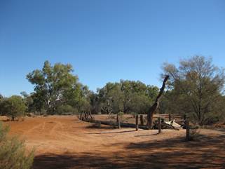
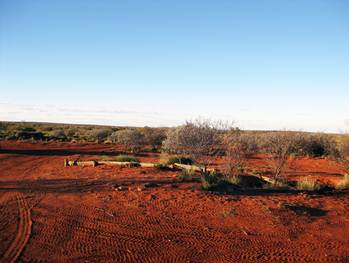
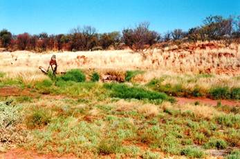
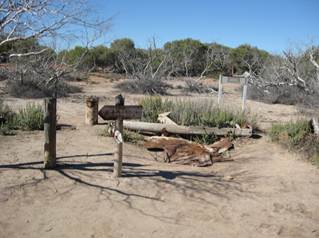
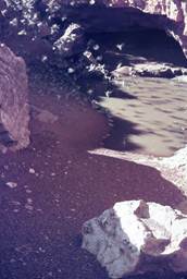
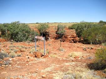
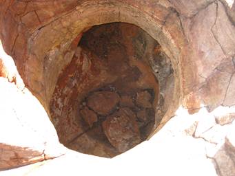
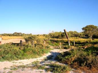
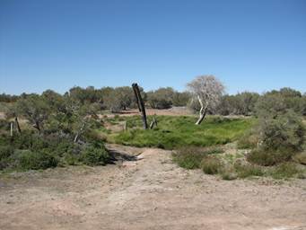
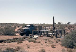
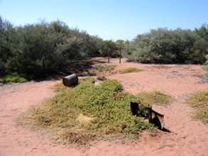
These four eras of photographs, although incomplete, provides a unique insight into the condition of the wells over time. There are wells that have been restored in the 4WD era, wells that are struggling to retain their structure against rust & rot and outright vandalism, and wells that have naturally become dusty holes or overgrown depressions.
It is unfortunate that Wells like 35 and 43 which supplied water to National Mapping field parties, especially during the geodetic survey of the 1960s, are among those which have deteriorated the most.
I have used only Well and Water names that could readily be sourced from readily available Canning material although all wells appear to now have an indigenous name.
All photos are used with permission and copyright applies.
|
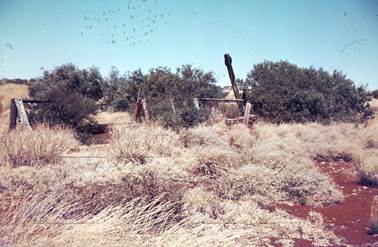
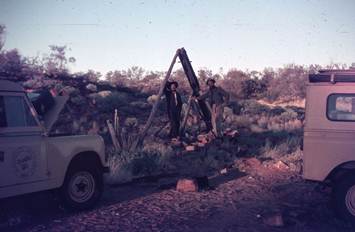
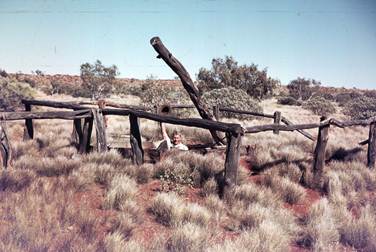
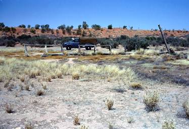
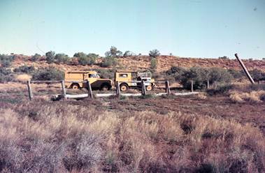
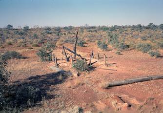
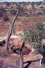
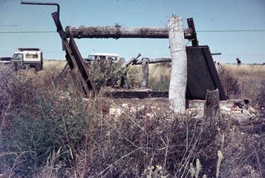
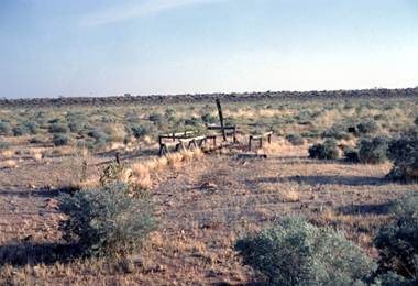
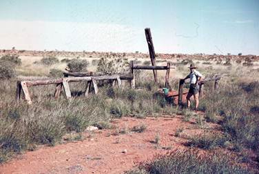
1961 & 62 by H.A. Johnson (Natmap) |
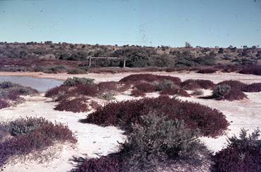
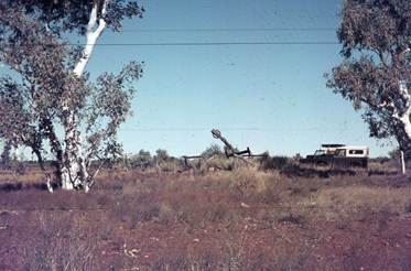
1967 & 68 by Wenholz & Chudleigh (ASO) |
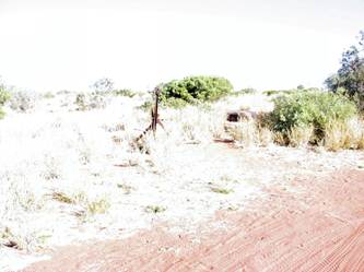
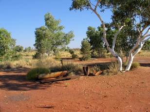
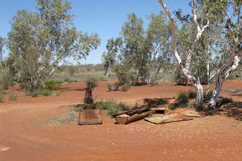
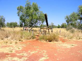
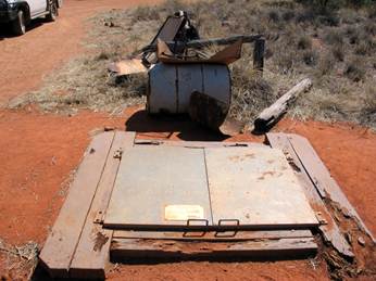
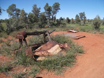
2007 by McLean & O’Connor (ex-Natmap) |
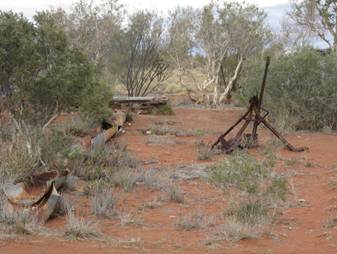
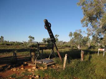
2010 by McLean, O’Connor, Porteous (ex-Natmap) |
|
|
|
|
|
|
|
|
|
|
|
No. 1 Well |
|
|
|
|
|
|
|
|
|
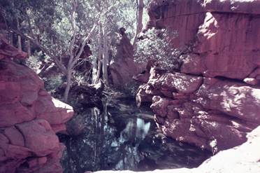
No. 1A Well North Pool |
|
|
From Web to complete set |
|
|
|
|
|
|
No. 2 Well |
|
|
|
|
|
|
|
|
|
No. 2A Well |
|
|
|
|
|
|
|
|
|
No. 3 Well |
|
|
|
|
|
|
|
|
|
No. 3A Well |
|
|
From Web to show comparison |
|
|
|
|
|
|
No. 4A Well |
|
|
|
|
|
|
|
|
|
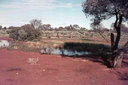
Windich Springs between No. 4A & 4B Wells |
|
|
|
|
|
|
|
|
|
No. 4B Well |
|
|
|
|
|
|
|
|
|
No. 5 Well |
|
|
|
|
|
|
|
|
|
No. 6 Well Pierre Spring |
|
|
|
|
|
|
|
|
|
No. 7 Well |
|
|
|
|
|
|
|
|
|
No. 8 Well |
|
|
|
|
|
|
|
|
|
No. 9 Well Weld Spring |
|
|
|
|
|
|
|
|
|
No. 10 Well |
|
|
|
|
|
|
|
|
|
No. 11 Well Goodwin Soak |
|
|
|
|
|
|
|
|
|
No. 12 Well |
|
|
|
|
|
|
|
|
|
No. 13 Well |
|
|
|
|
|
|
|
|
|
No. 14 Well |
|
|
|
|
|
|
|
|
|
No. 15 Well |
|
|
|
|
|
|
|
|
|
No. 16 Well |
|
|
|
|
|
|
|
|
|
No. 17 Water Killagurra |
|
|
|
|
|
|
|
|
|
No. 18 Well |
|
|
|
|
|
|
|
|
|
No. 19 Well Kunanaggi |
|
|
|
|
|
|
|
|
|
No. 20 Well |
|
|
|
|
|
|
|
|
|
No. 21 Well |
|
|
|
|
|
|
|
|
|
No. 22 Well |
|
|
|
|
|
|
|
|
|
No. 23 Well |
|
|
|
|
|
|
|
|
|
No. 24 Well |
|
|
|
|
|
|
|
|
|
No. 25 Well |
|
|
|
|
|
|
|
|
|
No. 26 Well |
|
|
|
|
|
|
|
|
|
No. 27 Well |
|
|
|
|
|
|
|
|
|
No. 28 Well |
|
|
|
|
|
|
|
|
|
No. 29 Well |
|
|
|
|
|
|
|
|
|
No. 30 Well Dunda Jinnda |
|
|
|
|
|
|
|
|
|
No. 31 Well |
|
|
|
|
|
|
|
|
|
No. 32 Well |
|
|
|
|
|
|
|
|
|
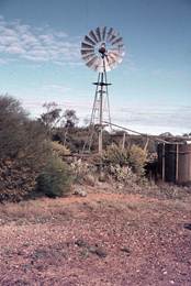
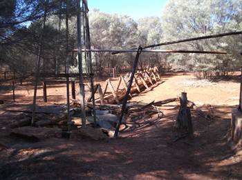
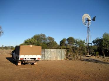
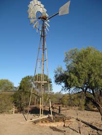
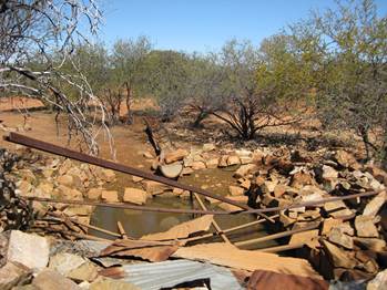
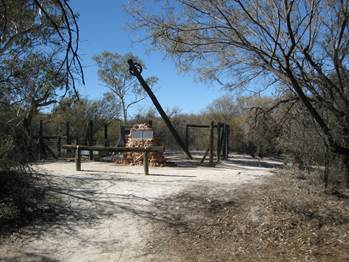
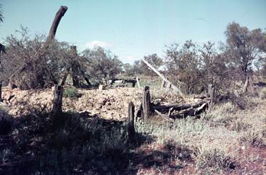
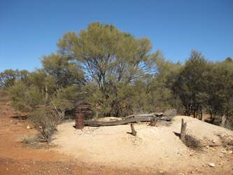
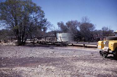
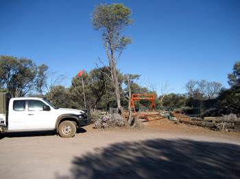
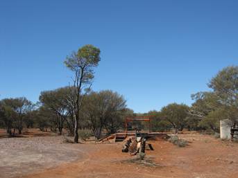
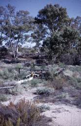
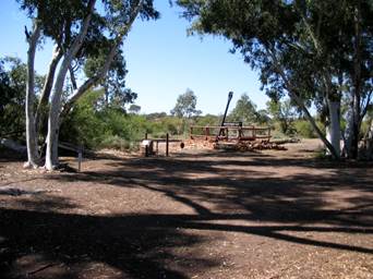
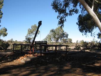
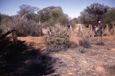
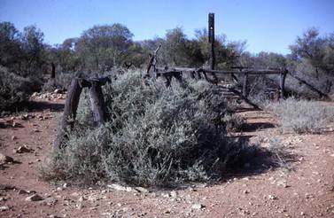
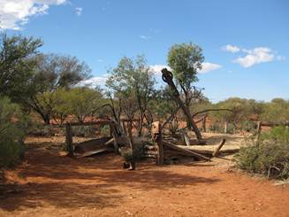
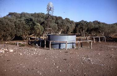
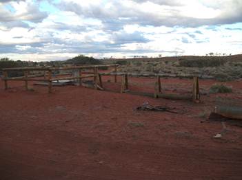
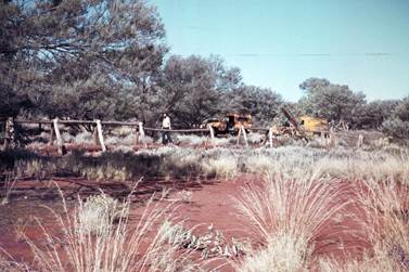
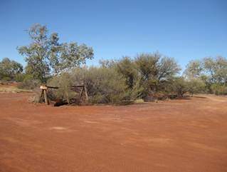
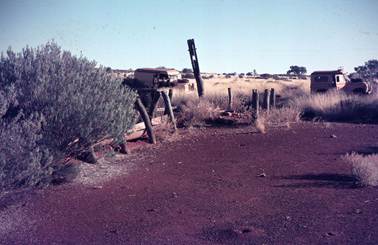
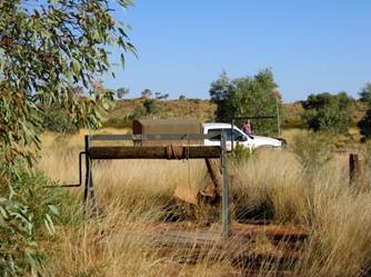
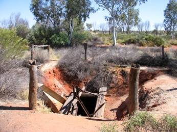
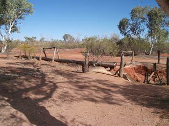
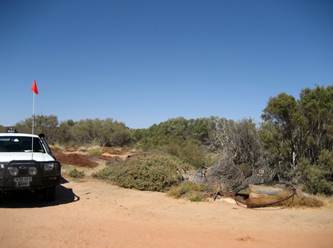
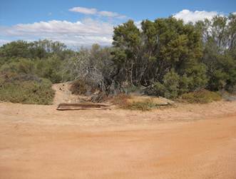
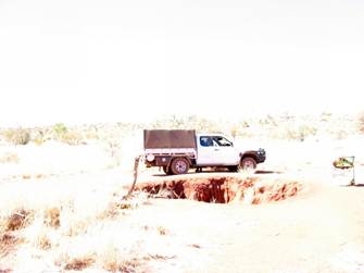
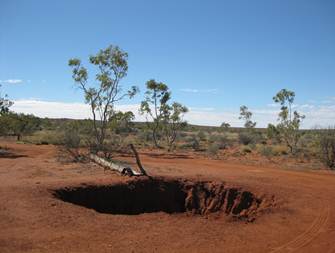
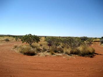
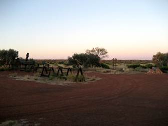
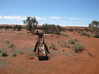
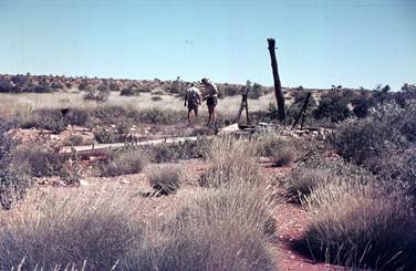
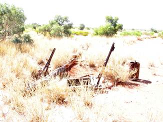
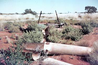
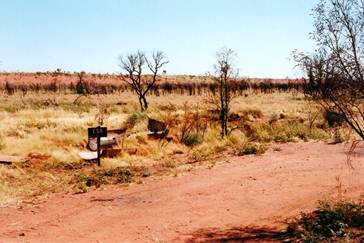
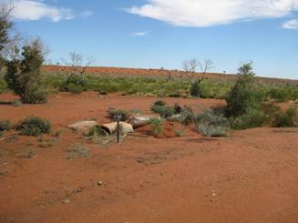
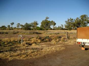
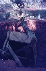
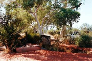
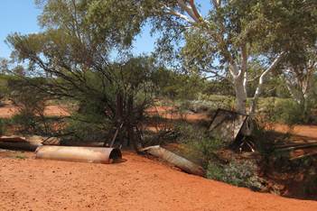
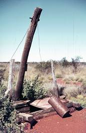
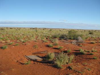
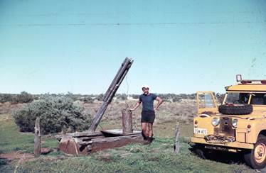
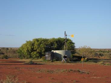
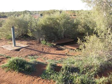
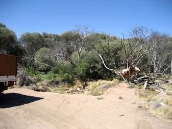
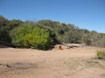
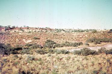
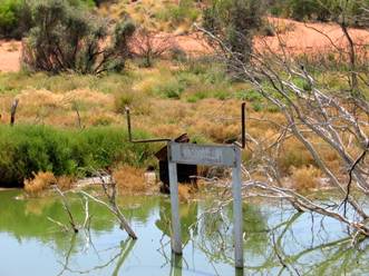
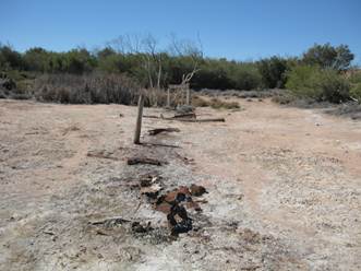
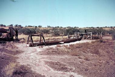
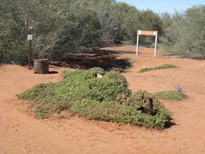
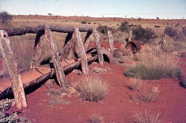
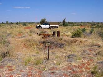
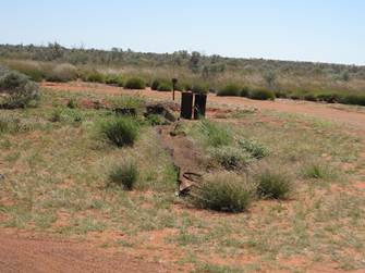
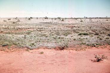
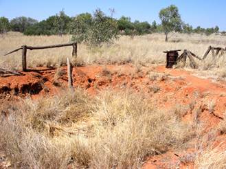
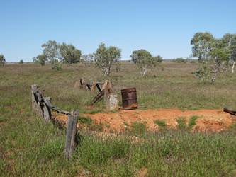
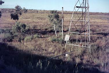
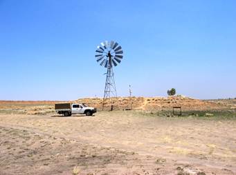
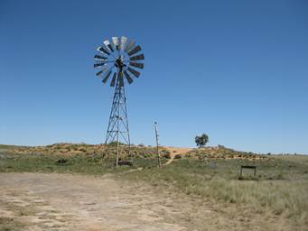
No. 33 Well |
|
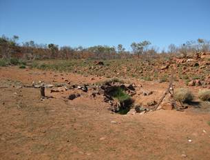
Modern mill at Well 33; original well site hidden |
by scrub some 15m east |
|
|
|
|
|
|
No. 34 Well Nibil |
|
|
|
|
|
|
|
|
|
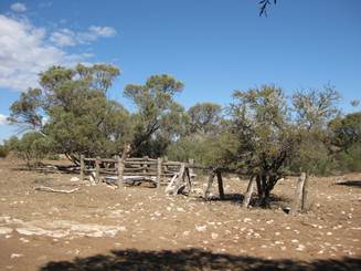
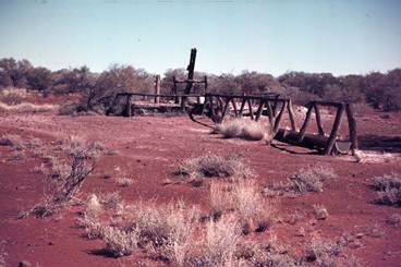
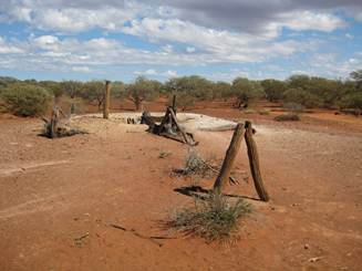
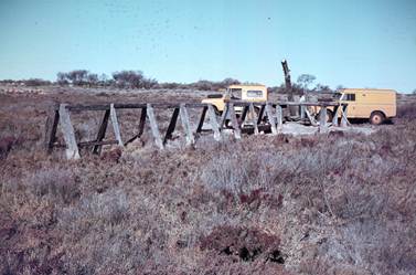
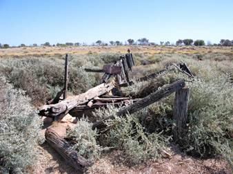
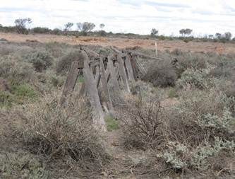
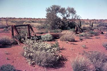
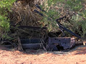
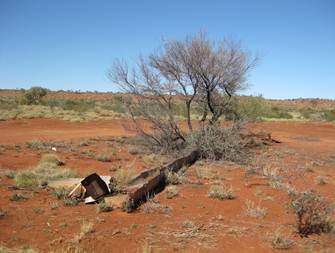
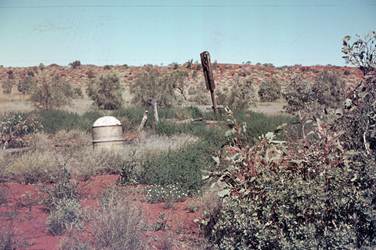
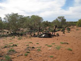
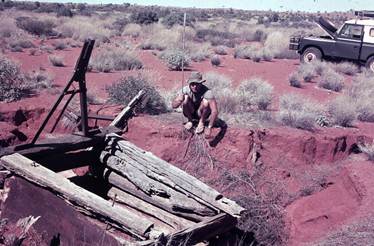
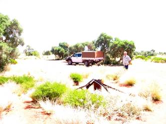
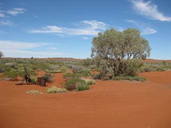
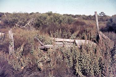
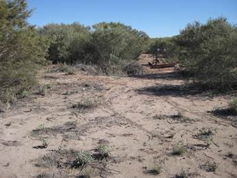
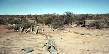
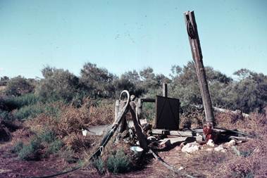
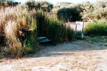
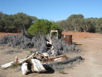
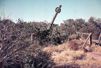
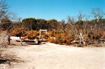
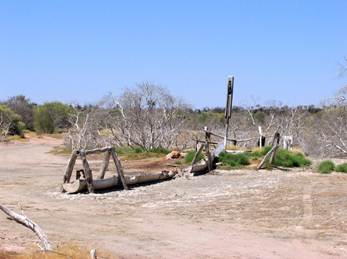
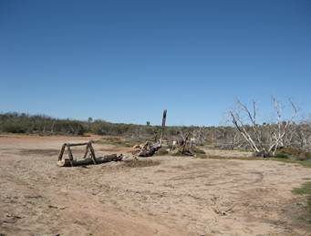
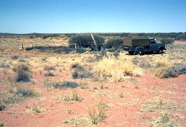
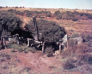
No. 35 Well Minjoo |
|
|
|
|
|
|
|
|
|
No. 36 Well Wanda |
|
|
|
|
|
|
|
|
|
No. 37 Well Libral |
|
|
|
|
|
|
|
|
|
No. 38 Well Wardabunni |
|
|
|
|
|
|
|
|
|
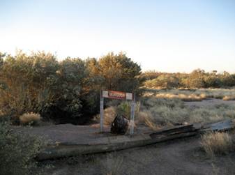
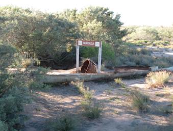
No. 39 Well Murguga |
|
|
|
|
|
|
|
|
|
No. 40 Well Waddawalla |
|
|
|
|
|
|
|
|
|
No. 41 Well Tiru |
|
|
|
|
|
|
|
|
|
No. 42 Well Guli |
|
|
|
|
|
|
|
|
|
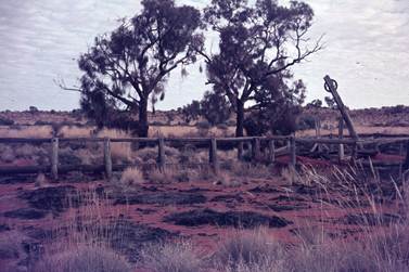
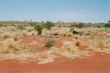
No. 43 Well Billowaggi |
|
|
|
|
|
|
|
|
|
No. 44 Well |
|
|
|
|
|
|
|
|
|
No. 45 Well |
|
|
|
|
|
|
|
|
|
No. 46 Well Kuduarra |
|
|
|
|
|
|
|
|
|
No. 47 Well |
|
|
|
|
|
|
|
|
|
No. 48 Well |
|
|
|
|
|
|
|
|
|
No. 49 Well |
|
|
|
|
|
|
|
|
|
No. 50 Well |
|
|
|
|
|
|
|
|
|
No. 51 Well Weriaddo |
|
|
|
|
|
|
|
|